Thursday, April 25, 2013

Pipeline Lined Up - Open Pit on Drill Site in Heritage Park Dug Out

Pipeline is being laid out on both sides of Howell Highway. Here on the side of Purse Funeral Home.


Here West of Howell Highway. An old barn was brought down to make room for the pipeline that will run towards the steep floodplain bluff of Beaver Creek (right behind the treeline).


 On the other side of Beaver Creek, the pipeline will pass very close to a county drain.


Meanwhile, pipes were delivered to the drill site in Heritage Park...


...and the open pit that took up the drilling mud was dug out showing that there is either no lining below the mud or the process of digging with an excavator is most probably damaging and puncturing the lining below, which should prevent chemicals from the drilling mud to drain into the soil. In preparation of the pipeline, a deeper new pit was dug next to the old one.
The first picture dates from 3/29/2013 and shows the original open pit.


Wednesday, April 24, 2013

Environmental Assessment of Witt Farm is not a Baseline

Just brief. The site assessment done by TolTest Inc. in June 2000 for the City of Adrian is a phase 1 assessment, which is done by a trained professional visiting the grounds, interviewing the owners and researching the site history. No actual testing (phase 2) was done as this was not indicated to be necessary by the findings of the phase 1 assessment, meaning there were no indications of previous industrial land use or any spills. Savoy will for sure not accept responsibility easily based on a phase 1 assessment - this is NOT a baseline!

Monday, April 22, 2013

Seismic Testing started at Hidden Lakes Garden

Communicated by Cynthia Waidley:
West Bay is doing extensive seismic testing at Hidden Lake Gardens (@750 acres) There is an exploration and drilling lease that was extended in 2012, @ $82,000. (original lease @$79,000).  Signed by Michigan State university.  Yet another local institution undermining the values they' and their many volunteers have spent years cultivating.

West Bay is, historically, more discreet and aesthetic in their siting than Savoy...they stipulated a 30 foot service road...

This was confirmed by Steven Courtney, the manager of Hidden Lakes Garden, who stated that "MSU has a long history with West Bay and agreements to protect sites that they have leased". 

What is it with people that (want to) believe that protected nature areas such as Heritage Park and Hidden Lake Gardens, as so many wild places in Colorado, Montana and Wyoming, can coexist with oil and gas exploitation? Wake up people, that is not possible. Sanctuaries are meant to be left alone AND protected - not commercialized, exploited and squeezed-out. You cannot have both! Either money that never reaches as far as it promises to do - and untouched, pristine sites. Knock-knock, anybody there? That is COMMON SENSE!

Saturday, April 20, 2013

Pipeline from Heritage Park to Witt Farm Laid Out - Through Flooded Wetlands

Savoy does not waste time. Stakes with blue flagging tape line out the pipeline that will soon be buried into the ground. Unfortunately, the pipeline will not follow streets and be above ground for easier checking for leaks - but cut straight through wetlands - that are currently flooded - crosses Beaver Creek, climbs up the flood plain bluff, crosses farmland, Howell Highway and then enters Witt Farm:

The Google Earth Profile shows a distance of almost 1 mile.


Here are some of the flagged stakes following the track. Starting at the drill site, which now exploits two wells.


Passes the sledge hill and enters the disc golf area.


Climbs down to the parking lot area.


Cuts through the disc golf area heading towards the wetland.


Turns right and follows the tree-line.


At the forest it turns left again. And heads again towards the wetland.


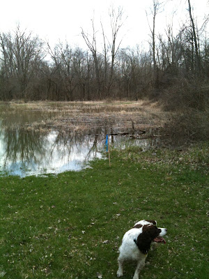
That is currently quite substantially flooded.


Here the flagging stops - I guess they did not want to get too wet...
After a while I found one last stake in the forest to the right of the above stake - right at the banks of Beaver Creek.


The forest at this area is quite remarkable being full of American buckeye and trout lilies.


I found the pipeline track again on the other side of Beaver Creek, where it cuts through farmland and approaches Howell Highway.


Crosses the highway, and cuts through more farmland to reach the Central Processing Facility on Witt Farm.


A few more impressions of the flooding that is going on, which attracts plenty of wading birds and swallows.


I wonder what will happen to a underground pipeline during a flooding like this???