Showing posts with label Beaver Creek. Show all posts

Saturday, August 10, 2013

Second Pipeline Mapped Out

Walked the Kiwanis trail today and found the famous blue stakes, so I followed them and mapped out the new pipeline until it enters the Frye Farm. Just to make sure, I did not enter into any marked private property and did not encounter any fences - I just followed the stakes from the public walkway shown in the first picture just below until back to the Kiwanis trail.


This gave me the general direction, where this straight part of the pipeline meets the straight portion crossing M52 and passing the residence shown in a picture on a previous post. My last guess was actually pretty close.

 There are 3 bottom holes off Carson, which all seem to be located on the Frye farm. The new pipeline is in red and refers to the elevation profile below the map. I also marked all current bottom holes on Witt Farm (Adrian 1-25), Purse Funeral Home (State Adrian & Purse 2-25), Statton's Landscaping (State Adrian & Stratton 1-24), and Heritage Park (Adrian Raisin 2-30)). Please note that many of these wells exploit several locations by drilling horizontally. Old pipeline from Heritage to Witt in blue

I check out if I could see anything of the two bottom holes in the southwestern corner of Frye Farm and was thrilled that I could get a peak just west of the Kiwanis trail that was not marked as private property and was not fenced in. Please note that I did not step on the open grassland, which is obviously private property...
Unfortunately, there was nothing to be seen. Frye 1-26 may not been drilled yet ??? and Frye 2-26 is in the forest and not visible (or is also not drilled yet???).

 The forest opening in the middle of the picture leads to Frye 2-26 but it goes way into the forest
The Frye farmhouse with a excavator and already assembled pipes for the pipeline.

 Shortly after the above pictures, Kiwanis trail crosses Beaver Creek. The bottom hole Frye 2-26 (Carson 4) is 30 ft. right above the creek. Frye 1-26 (Carson 3) is a little further away but also just 40 ft. above the creek bed. It is very easy for contaminated ground water or surface water to reach the creek.

Frye 2-26 (Carson 4) is 30 ft. right above the creek (see profile above), Frye 1-26 (Carson 3) is 40 ft above the creek bed.


Oils residue above mud in a ditch next to Kiwanis trail close to Frye 1-26


Beaver Creek towards NW as seen from the Kiwanis trail bridge


Sunday, August 4, 2013

Track of the New Pipeline Becomes Clearer

The pipeline progressed much further than I thought. It is well hidden behind one row of corn plants. After a few pictures from Wizz Computer opposite of Witt Farm you follow me South on M52 towards Adrian. The pictures were actually made after returning North bound out of the city to have a better view - but I present them here as if you are going South from Witt Farm.


Here the pipeline will cross M52

Seemingly running towards this house (see the blue flagging stake). Adding up to something like this. Probably achieved by horizontal drilling from the corn field to the drill site of Carson?


There is also substantial work going on at the Carson Highway end of the pipeline. As in the case of Savoy's 1st pipeline from Heritage Park to Witt Farm, again it looks like there are 5 parallel pipes to avoid getting a permit for one larger pipeline for going under Beaver Creek. This will again involve horizontal drilling. Whether they will drill horizontally all the way from Carson to the corn field across M52 - or just under M52, then have the pipes buried 4 feet under going through the property on the west side of M52 shown above, and again drilling horizontally under Beaver Creek and then again standard 4 feet under ground to the Carson site is not clear yet - and it will be difficult to follow as it will go almost entirely through private land...


Again, Savoy's pipelines pass through very close to nationally recognized wetlands and cuts under Beaver Creek and through - or under one of the largest forested areas within or close to city limits.


Wednesday, June 5, 2013

Drilling on Stratton's Landscaping Done - Derrick Moved Next to Purse Funeral Home

After about 2 weeks of drilling on the property of Stratton Landscaping between Heritage Park and M52, the specialized derrick for horizontal drilling was disassembled on Monday, and just moved across Beaver Creek Howell Highway to the property of Purse Funeral Home, where a "christmas tree" capped the bore hole from a previous - supposably unsuccessful conventional drill.

Drilling Derrick on Stratton's last Saturday (June 1).


Intensive grading to prepare for more drilling also on Saturday, June 1 on the Purse Funeral Home Site. Note the "christmas tree" capping the old bore hole.

Yesterday morning, the special derrick for horizontal drilling was swiftly moved just across Beaver Creek and Howell Highway to the new drill site at the Purse Funeral Home.


The derrick arrived on the Purse Site on Tuesday, June 4th 10:27 EDT.

And was setup within a couple of hours. The first two pictures are from around 11:30 am, just an hour after the last 2 pictures.


And was soon erected.

At 4:30 pm yesterday, the derrick looked almost functional..


An hour later (6/4/2013 at 5:22 pm).


And today (6/5/2013) at 10:50 am.


Thursday, May 16, 2013

Pipeline from Heritage Park to Witt Farm still on Halt

Just a brief update. The pipeline is under ground - the only piece still missing is a short clearcut from the disc golf area to Beaver Creek, passing very close to a county drain, going under the bed of Beaver Creek, climbing up the flood plain bluff, and connect to the pipes waiting on the farmland West of Howell Highway. I don't know what they waiting for? It is already 3-5 days...Maybe permits or scheduling of another 3rd party crew??

Thursday, May 9, 2013

Pipeline Now Also Buried on the Floodplain

Unfortunately, I was wrong - seems to be no problem to submerge the pipes totally under water. Note the dark, almost black swamp muck indicating that the soil is soaked with water for a substantial part of the year.

 Now only the 10 pipes to go through the woods, under Beaver Creek and up the bluff are lined up next to the newly buried pipes.


 Here is the end of the buried pipes. You can see the 2 stakes shown later that indicate the direction of the connecting piece.
 And the PE pipe to bring the flare gases and vapors to Witt Farm.
 I hope they will not do too bad of a clearcut to put the pipes through the woods - and I am really curious how they will put the pipes under the creek.

Tuesday, May 7, 2013

Pipeline Goes Underground in Heritage Park

The pipes that will be buried into the flood plain are still above ground. Note the almost 90° angle from the straight down direction from the drill site towards Beaver Creek. This shows that the originally staked track will be simplified by going diagonal through part of the disc golf lawn and then cut straight through to the already laid straight track on the farm sites above the floodplain.


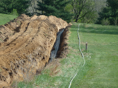
The five metal pipes buried 4 ft crossing the field road to the disc golf area.  Please note the still high level of ground water under the pipes.
The connection to the flood plain pipes still needs to be made.
 Ground water level is still very high. The pipes would sit in water if lowered into the trench.
 Closeup to where the pipes cross the disc golf service road. You can clearly see the 5 metal pipes and a sixth plastic pipe (what for?)
 Strange attachments on pipes waiting to be buried. Are these floating devices - but what about the wires?
Asphalt gravel is distributed and is spread out over the road crossing using a caterpillar.


On the North side of the service road towards the Heritage drilling site, the pipes leave the 4 ft. trench and have to be carefully lifted into trench  step by step.


On the way back from our walk (40 minutes later), 5 metal pipes are inside of the trench facing the floodplain. A sixth metal pipe is still outside. In some areas the pipes look very zig-zaggy - not very trustworthy...

But still have to be laid underground one-by-one for another 50 yards towards the Heritage Park drilling site.

At the same pace the excavator progresses some 100 yards ahead towards the drill site.