
Iceland Glacier Gone

Friday, August 9, 2013
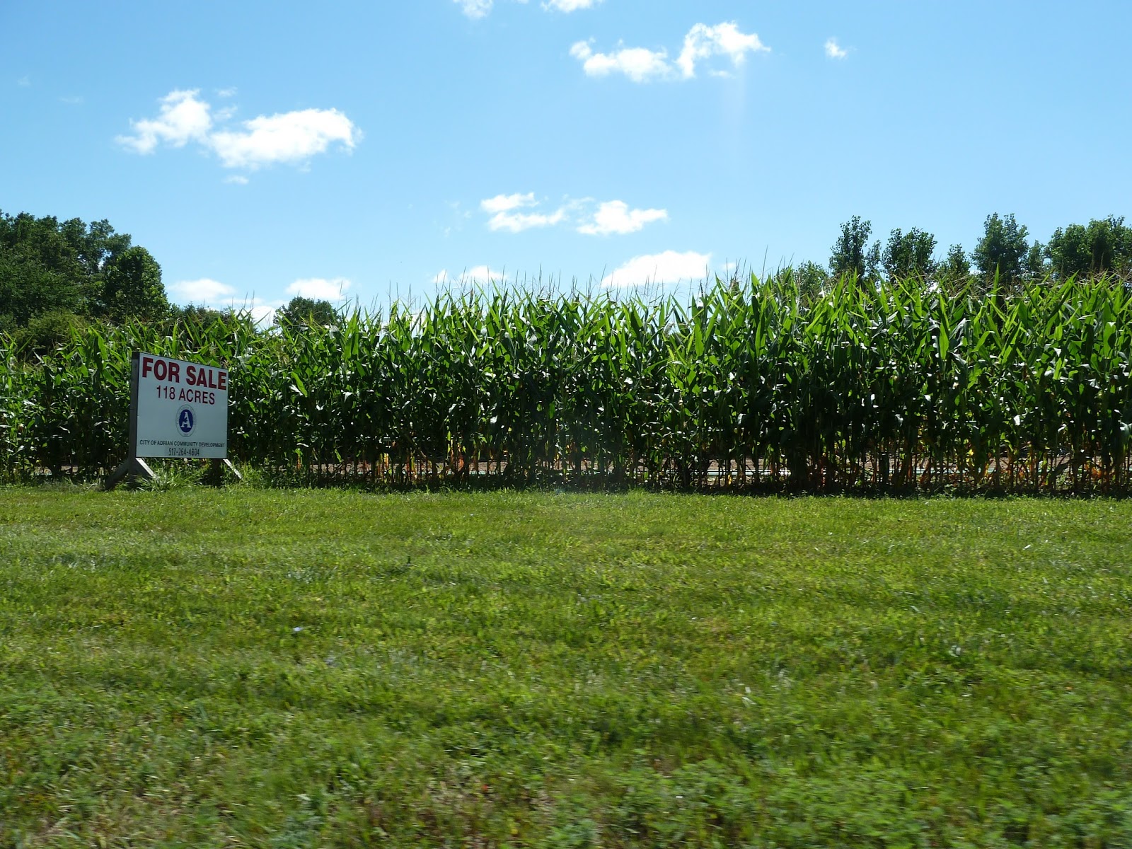
Permitted well off country club road is now being developed
Right when coming down the road from Budlong, past Scott - but on right side.

Huge Flare on Stratton's
The hugest flare that I ever saw is up on Stratton's Landscaping.
BTEXs are definitely smellable from the lower soccer stadium at Heritage Park. Definitely a health risk for kids playing soccer there.
No pics from the flare - it is difficult to see - the entire area is quite hidden. However, the DEQ site shows that they now drilled 3 directional wells from the bottom hole at Strattons - one of them, the newest quite far.

No pics from the flare - it is difficult to see - the entire area is quite hidden. However, the DEQ site shows that they now drilled 3 directional wells from the bottom hole at Strattons - one of them, the newest quite far.

Monday, August 5, 2013
Consumer Energy Hooks Up the Pump in Heritage Park
The pump in Heritage Park was not working for a while now even though the generator was roaring all the time. I thought it was not necessary after Savoy had the well re-drilled a week ago. Today Consumer Energy was connecting the well area to the grid on Heritage Park, temporarily blocking off driving access to the lower part of the Park (disk golf and model plane field). As soon as they had the box hooked up the pump started working - indicating that the generator did not provide enough power?
Today (August 9) the pump was off and the generator is still roaring despite having electricity from the grid. Seems wasteful to me...


Today (August 9) the pump was off and the generator is still roaring despite having electricity from the grid. Seems wasteful to me...


Sunday, August 4, 2013
Track of the New Pipeline Becomes Clearer
The pipeline progressed much further than I thought. It is well hidden behind one row of corn plants. After a few pictures from Wizz Computer opposite of Witt Farm you follow me South on M52 towards Adrian. The pictures were actually made after returning North bound out of the city to have a better view - but I present them here as if you are going South from Witt Farm.


Here the pipeline will cross M52

Seemingly running towards this house (see the blue flagging stake). Adding up to something like this. Probably achieved by horizontal drilling from the corn field to the drill site of Carson?

There is also substantial work going on at the Carson Highway end of the pipeline. As in the case of Savoy's 1st pipeline from Heritage Park to Witt Farm, again it looks like there are 5 parallel pipes to avoid getting a permit for one larger pipeline for going under Beaver Creek. This will again involve horizontal drilling. Whether they will drill horizontally all the way from Carson to the corn field across M52 - or just under M52, then have the pipes buried 4 feet under going through the property on the west side of M52 shown above, and again drilling horizontally under Beaver Creek and then again standard 4 feet under ground to the Carson site is not clear yet - and it will be difficult to follow as it will go almost entirely through private land...

Again, Savoy's pipelines pass through very close to nationally recognized wetlands and cuts under Beaver Creek and through - or under one of the largest forested areas within or close to city limits.
Enbridge Tries to Bypass Keystone XL in Our Area (Livingston County)
Another Major Tar Sands Pipeline Seeking U.S. Permit
Canadian energy giant Enbridge is quietly building a 5,000-mile network of new and expanded pipelines that would achieve the same goal as the Keystone

Having so many pipelines and so much construction going on in our region costs us and the environment:
Enbridge damage: Utility, road fixes could hit $1 million
Road and utility damage in Howell Township believed to have been caused by Enbridge Energy LP could reach $1 million, Mike Craine, Livingston County Road Commission managing director, said last week.Full story here: http://www.livingstondaily.com/article/C4/20130429/NEWS06/304290056/Enbridge-damage-Utility-road-fixes-could-hit-1-million
Enbridge cited for discharge in Hartland
Read the story here: http://www.livingstondaily.com/apps/pbcs.dll/article?AID=2013307040002The spill was caught on this Youtube video: http://www.youtube.com/watch?v=2XKoYuTQi7o
Such massive misconduct brought tar sand pipeline watchdogs on the plan. MICATS (Michigan Coalition Against Tar Sands, https://www.facebook.com/michigancats) arranged a non-violent direct action including a sit-in of some activist tied to the machinery. Livingston Daily reported about this:
12 arrested at Enbridge protest
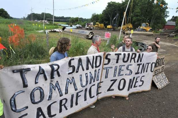


Read the full article here:http://www.livingstondaily.com/apps/pbcs.dll/article?AID=2013130723003
Read also a commentary by Mickey Hirten today: Enbridge Energy has a credibility problem http://www.livingstondaily.com/apps/pbcs.dll/article?AID=2013308040016
Saturday, August 3, 2013
Breaking News: New Pipeline SW of Witt Farm Under Construction
Pipes for a new pipeline leading more oil wells to Witt Farm are being assembled right now. As I did not see any stakes indicating the direction of the pipeline track, I suspect this to connect to horizontal drilling from the Carson Highway site.

This would bring the oil of three additional wells to the central processing facility (tank farm) on Witt Farm - and by that increase the already large flare emitting toxic and cancerous BTEXs and other compounds, most probably even hydrogen sulfide and hydrogen chloride (hydrochloric acid).


This would bring the oil of three additional wells to the central processing facility (tank farm) on Witt Farm - and by that increase the already large flare emitting toxic and cancerous BTEXs and other compounds, most probably even hydrogen sulfide and hydrogen chloride (hydrochloric acid).


Savoy's Oil Production in our Area
I tried to pull the public data on well production on the DEQ website at http://www.michigan.gov/deq/0,1607,7-135-3311_4111_4231-98518--,00.html but it is not as easy as you would think. Data are stored as PRU (Production Reporting Unit) and have to be aligned to the well permit number, which could be easier, and is not always a 1:1 relationship, meaning a PRU can include several wells - and there is no convenient way to export the more than 2 months old data from the Online Data Base at http://ww2.deq.state.mi.us/mir/ so I had to write the numbers down. There is also a Microsoft Access data base that you can download but it is even more behind (lacks data for April and March 2013!). I finally managed to get these numbers:
First, Savoy is the 3rd largest exploiter of crude oil in Michigan at a 2013 total of 236606 barrels. The largest player is West Bay Explorations, which exploit the oil fields in the Irish Hills at 811494 barrels in 2013. Number 2 is Merit Energy at 457779 barrels. These numbers are from March 2013 though!
The below table is a small selection of the total oil production in our area. I just pulled the two wells closest to the City of Adrian and two wells more NW in Adrian township, and SE in Palmyra township. However, some wells in these areas are producing more, others less than the figures shown. The two selected locations are in no way representative for their areas.
|
|||||||||||||||||||||||||||||||||||||||||
| The oil companies have 45 days from the end of a month to report (yes, you heard right - they monitor how much they make themselves - there is no calibrated device that measures production) - then the overworked and understaffed DEQ has to compile and update the database - resulting in a time lag of currently more than 2 months. Therefore we do not have data on any newer wells yet - or more recent changes in production of present wells. Therefore there are no data yet on the wells on the Purse Funeral Home, Stratton's Landscaping, or the 1-3 wells off Carson Highway. | |||||||||||||||||||||||||||||||||||||||||
Subscribe to:
Posts (Atom)